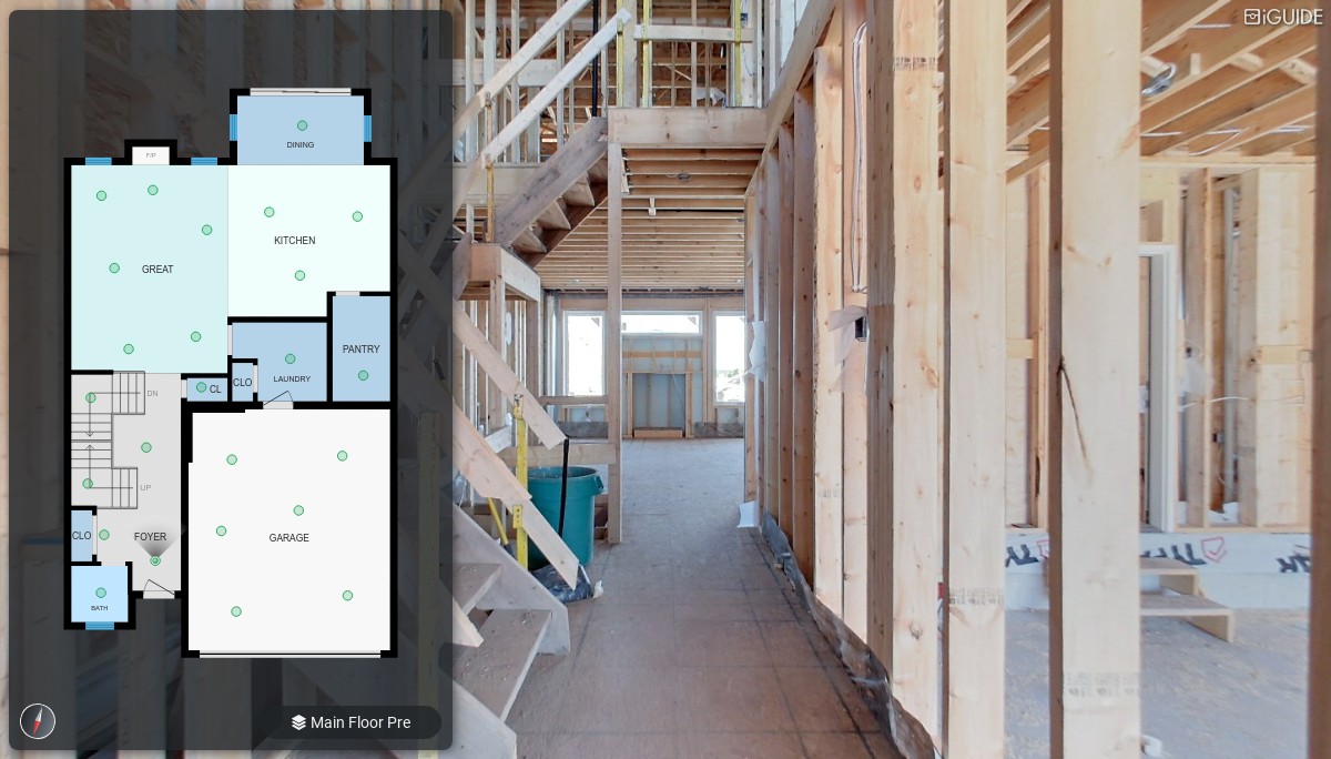
Geospatial Technology

Home / Geospatial Technology

Precise floor plans & 3D virtual tours made easy

PLANIX

Measure, document and photograph a space simultaneously! Using a 360° time-of-flight lidar scanner with accuracy exceeding industry standards.


iGUIDE

Converts PLANIX camera data into iGUIDE 3D virtual tours, including accurate floor plans, 360° images, room dimensions, photos and more.

As easy as 1-2-3

Capture

Connect Your iGUIDE PLANIX camera to your smart device, create a new project and start scanning the property.
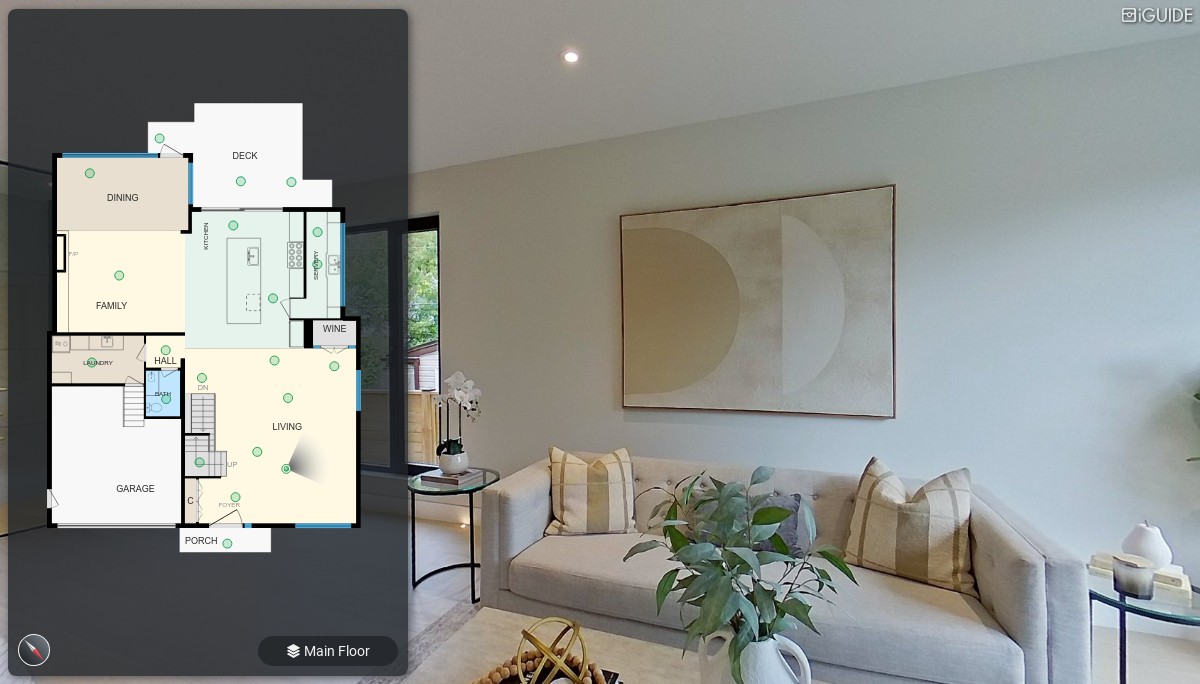
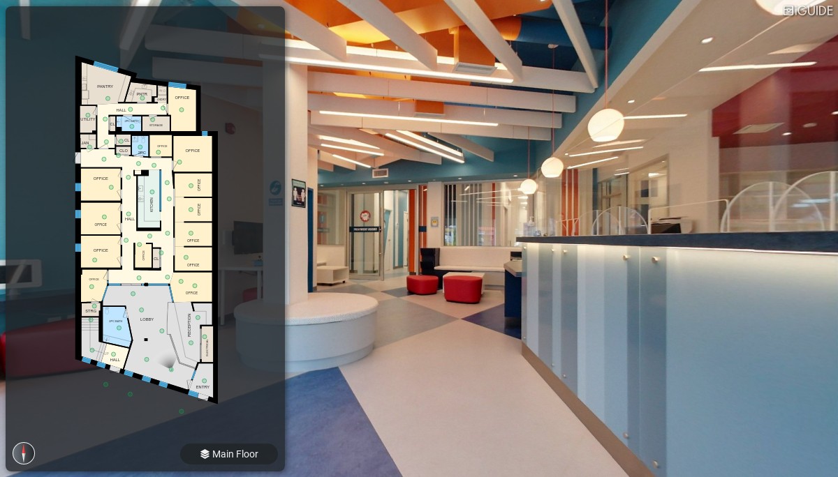
Process

Upload your data to the iGUIDE Portal, where your iGUIDE 3D Virtual Tour, Shcematic Floor Plan, DWG, or ESX files will be available once ready.

More Value From Your Data

Easily share your files, post on social media, or upload to your website. iGUIDE file formats integrate with smart devices and web platforms.

WHY EQUINOX

Precise floor plans in an instant

Capture floor plans and 3D virtual tours in a single visit using the iGUIDE PLANIX camera system. It’s fast, accurate and provides flexible file types. Quickly create precise floor plans for real estate listings, construction projects, insurance claims and facility documentation.

Looking for an iGUIDE 3D virtual tour and floor plan without purchasing an iGUIDE camera system? Find a local iGUIDE Service Provider near you!

Accurate Measurements

iGUIDE is chosen by contractors, architects and engineers worldwide.

Superior Navigation

User-friendly 3D virtual tours that anyone can easily navigate from their desktop or phone.

Compliant Solution

iGUIDE floor plans and area calculations adhere to the ANSI-Z765-2021 and RECA RMS 2017 standards.

Dive into the iGUIDE experience

The iGUIDE PLANIX does more than just take pictures. Unlike a conventional camera system, it measures and photographs a space — simultaneously. This reduces time spent in each space as you quickly capture information for a virtual tour and floor plans.

Why choose iGUIDE?

Accurate Floor Plans

Typical distance measurements on a floor plan have a measurement uncertainty of 0.5% or less.

3D Tour In Minutes

Create a 3D virtual tour in as little as 15 minutes for a 3,000 sq ft property.

No Monthly Fees

No recurring fees. Pay only for the processing and files you need instead of an expensive subscription.

Detailed Reports

Impress your partners or clients with comprehensive reports, including property dimensions, measurements and details.

Flexible file formats

Digital file formats compatible with Xactimate, CAD, website platforms and social media.

Own Your Data

The choice is yours – keep a digital download of your files or host them on our secure hosting platform.

iGUIDE excels in different industries

Real Estate

Real Estate Photography

Architecture & Remodeling

Commercial Design

Insurance & Restoration

Facility Management

OUR PRODUCT

Simple to use tools for intricate security requirements

Network Security Solutions

Advanced Threat Detection Systems​

Data Encryption and Protection

Have Any Question?

HELP & SUPPORT

Some More Frequently Asked Questions.

What are the key applications of Geospatial Technology?

Geospatial Technology has a wide range of applications across industries. Some of the key uses include:

  • Urban Planning: Mapping cities and infrastructure to optimize space and resource management.
  • Environmental Monitoring: Tracking climate change, deforestation, and natural disasters.
  • Agriculture: Precision farming, crop monitoring, and land use management.
  • Logistics and Transportation: Route optimization, fleet management, and navigation.
  • Real Estate and Construction: Site selection, land surveying, and project planning.
How does Geospatial Technology help in decision-making?

Geospatial Technology enables businesses and governments to make data-driven decisions by visualizing and analyzing geographic data. By mapping data points, stakeholders can identify trends, patterns, and relationships that might not be visible otherwise. This helps in better decision-making for infrastructure development, disaster management, environmental protection, and resource allocation.

What are the benefits of using Geospatial Technology?

The benefits of Geospatial Technology include:

  • Improved Data Accuracy: Provides precise geographical data for better planning and decision-making.
  • Cost Efficiency: Helps optimize resources and reduce operational costs in areas like construction and agriculture.
  • Enhanced Visualization: Visual representation of data makes it easier to interpret and analyze complex information.
  • Real-Time Monitoring: Enables real-time tracking and analysis, crucial for logistics, public safety, and environmental management.

TESTIMONIALS

At VektorZ, We launch innovative solutions for quick results.